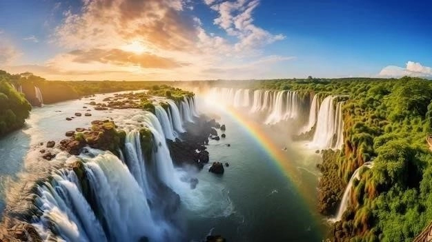
Victoria Falls, locally known as Mosi-oa-Tunya, meaning “The Smoke that Thunders”, is a waterfall located on the Zambezi River, forming the border between Zambia and Zimbabwe․ It is one of the largest waterfalls in the world, renowned for its breathtaking beauty and sheer power․ The formation of Victoria Falls is a testament to the immense forces of geology that have shaped our planet over millions of years․
Geological History and Formation
The story of Victoria Falls begins over 180 million years ago, during the Jurassic period․ Heres a breakdown of the key events:
-
Basalt Formation (180 Million Years Ago)
Extensive volcanic activity in southern Africa led to the deposition of thick layers of basalt, a dark-colored volcanic rock․ This basalt, reaching up to 300 meters thick, forms the foundation upon which Victoria Falls sits․
-
Gondwanaland Breakup and Joint Formation (110 Million Years Ago)
As the supercontinent Gondwanaland began to break apart, tectonic forces created stress lines and cracks, known as joints, in the basalt․ These joints, mostly running east-west, became crucial for the future path of the Zambezi River․
-
The Proto-Zambezi River (15 Million Years Ago)
Prior to the formation of Victoria Falls, the Zambezi River, as we know it today, did not exist․ Instead, a different river system flowed across the region․ Uplifts in the Earths crust, known as the Miocene warping upheavals, dramatically altered these ancient river systems․
-
Formation of the Batoka Gorge and River Capture
The Miocene warping upheavals also created a ridge that blocked the flow of the upper Zambezi River․ This led to the formation of a massive inland lake․ Over time, the middle Zambezi eroded backward into this lake, eventually capturing its waters in a catastrophic flood․ This floodwater carved out the Batoka Gorge, a deep chasm cutting through the basalt, and connected the upper and lower Zambezi, setting the stage for Victoria Falls․
-
The Birth of Victoria Falls
With the newly connected Zambezi River flowing over the hard basalt, the process of erosion began․ The powerful water flow exploited the pre-existing cracks and weaknesses within the basalt, carving out the first gorge․ As the river eroded the softer materials within the joints, the harder basalt upstream formed cliffs, creating the first waterfall․
-
The Retreating Waterfall
Victoria Falls is not static; it is constantly evolving․ The erosive power of the water continues to undercut the basalt, causing sections to collapse․ This process has caused the waterfall to “retreat” upstream over millions of years, leaving behind a series of eight distinct gorges downstream of the current falls․ Each gorge represents a past position of Victoria Falls․
The Future of Victoria Falls
Geologists believe that the process of erosion and gorge formation will continue․ The current falls will eventually retreat further upstream, leaving behind a ninth gorge․ The exact timeline for these geological events is vast, measured in tens of thousands to millions of years․
The Importance of Understanding the Geology
Understanding the geological history of Victoria Falls is not just an academic exercise․ It is crucial for:
- Conservation Efforts: Knowing how the falls have evolved helps conservationists protect this natural wonder from the impact of climate change and human activities․
- Tourism Management: Geological insights inform the development of safe and sustainable tourism infrastructure around this popular destination․
- Appreciating the Landscape: A grasp of the geological forces at play enhances the visitors appreciation for the beauty and power of Victoria Falls․
Victoria Falls stands as a testament to the immense power of nature, a magnificent waterfall sculpted by the relentless forces of geology over millions of years․ Its continued evolution promises a future as captivating as its past․
Victoria Falls: A Deeper Dive into its Geological Significance
Beyond its visual splendor, Victoria Falls presents a compelling case study for geologists and geomorphologists․ The intricate interplay of geological structures and erosive forces has resulted in a landscape of remarkable complexity, offering invaluable insights into the Earths dynamic processes․
Structural Control on Gorge Formation: A Closer Look
The characteristic zigzag pattern of the gorges downstream from Victoria Falls is not a random occurrence․ It points to a strong structural control on the rivers erosive power․ Several factors contribute to this phenomenon:
- Joint Systems: As previously mentioned, the basalt bedrock is dissected by a network of joints, primarily oriented east-west․ These joints represent zones of weakness, more susceptible to erosion by the river․ The initial path of the Zambezi River was likely influenced by these pre-existing fractures․
- Fault Zones: In addition to joints, geological evidence suggests the presence of fault zones within the basalt․ Faults are larger-scale fractures where there has been significant movement of the Earths crust․ These zones exhibit even greater weakness and would have been preferentially eroded by the river, contributing to the abrupt changes in gorge direction․
- Differential Erosion: Not all basalt is created equal․ Variations in the basalts composition and cooling history can result in areas of differing resistance to erosion․ The Zambezi River, following the path of least resistance, would have exploited these variations, carving more rapidly through weaker zones and creating the alternating gorge segments․
Implications for Landscape Evolution Models
The study of Victoria Falls geological history has broader implications for our understanding of landscape evolution:
- Headward Erosion: Victoria Falls provides a prime example of headward erosion, where the erosive power of a river gradually cuts upstream, extending the length of a valley or gorge․ The series of abandoned gorges downstream stand as a testament to this ongoing process․
- Role of Geological Structures: The prominent influence of joints and faults at Victoria Falls highlights the significant role that pre-existing geological structures play in shaping landscapes․ Rivers, though powerful, often follow the blueprint laid out by these ancient weaknesses within the Earths crust․
- Rates of Erosion: By studying the dimensions of the gorges and estimating the time it took for their formation, geologists can make inferences about the rates of erosion at Victoria Falls․ This data is valuable for understanding the long-term evolution of landscapes and the factors that influence erosion rates․
Victoria Falls: A Continuous Geological Story
Victoria Falls is not a static monument but a dynamic system, constantly reshaping itself through the interplay of geological forces and erosion; As the Zambezi River continues its relentless work, future generations can expect to witness the ongoing evolution of this natural wonder, further enriching our understanding of our planets dynamic history․